Exit

Telephone : +44 (0) 28 7083 4600

Email: info@irishartgroup.com

Speed “The Province of Ulster” … 1676

“The Province of Ulster” … 1676 by John Speed (1542 – 1629). Full later hand colour. 15” x 20” (37 cm x 50 cm). Speed is recognized as the finest cartographer these islands every produced. Cambridge University Library describes his “Theatre of the Empire of Great Britaine” (1611/1612) “as one of the world’s great cartographic […]

Read more Like this post2

Jansonsius “Hibernia Regnvm Vulgo Ireland” c. 1633 SOLD

“Hibernia Regnvm Vulgo Ireland” c1633 … by Johannes  Jansonius Jr. (1588 – 1664).  Copperplate engraving… full original hand colour. 15” x 20” (38 cm x 50 cm). Published in Amsterdam. Ireland oriented East West. Janssonius was born in Arnhem, the son of Jan Janszoon the Elder, a publisher and bookseller. In 1612 he married Elisabeth […]

Read more Like this post1

Beaufort “Civil and Ecclesiastical Map of Ireland” 1792 SOLD

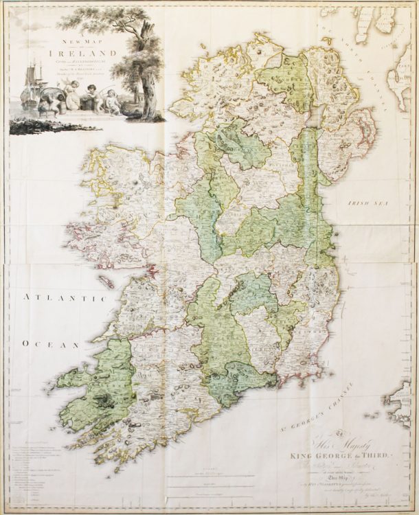
“Civil and Ecclesiastical Map of Ireland”…1792 by Rev Daniel Augustus Beaufort (1729 -1831)…42” x 37” (109 cms x 91 cms)… original full hand colour.. published in London on March 1st 1792 by W Faden and W Allen. This is a rare first edition of both these maps in excellent condition. The map sold for sixteen […]

Read more Like this post1

Greenvile Collins “Carrickfergus Lough”… c. 1750

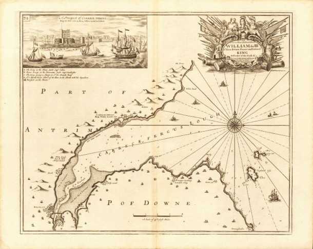
“Carrickfergus Lough”… c1750…. original copperplate nautical chart from “Great Britain’s Coasting Pilot” published in 1693 …25” x 20” (63cms x 50cms)… Captain Greenvile (or Greenville) Collins R.N.(1645 – 1694). Collins was a prominent hydrographer, commissioned by King Charles II in 1676 and appointed by Samuel Pepys (then Secretary to the Admiralty), to chart the coasts […]

Read more Like this post0

“Belfast”… 1873 SOLD

“Belfast”… 1873 … from “Harper’s Hand Book”… 8” x 6” (21 cms x16 cms) … published in New York by Harper and Brothers in 1879. Map Ref: 951 This map has been SOLD but if you would like us to source one for you please email megan@irishartgroup.com or phone Darach on 0044 (0)28 7083 4600

Read more Like this post1

Stieler “Ireland”… 1869

“Ireland”… 1869 … Adolf Stieler (1775 – 1836)….from “Stieler’s Hand Atlas 6th edition”… 15” x 12.5” (38 cms x 32 cms) … “Der Hand-Atlas über alle Theile der Erde und über das Weltgebäude” (Handy atlas of all parts of the world and of the universe), was the leading German world atlas of the last three […]

Read more Like this post0

Walpoole/Hogg “Ulster”… 1784 SOLD

“Ulster”… 1784…George Augustus Walpoole… (one of Alexander Hogg’s several assumed names).. from The New British Traveller….later hand colour… 12” x 7.5” (31 cms x 19 cms) … The New British Traveller was originally issued as a 60 weekly part-work by Hogg. Commencing in 1783, the series was completed in 1784. Titles were provided for the […]

Read more Like this post0

Perrot “Cavan/Monaghan”…1828

“Cavan/Monaghan”…1828 by Aristide Michel Perrot (1793 – 1879) …4.5” x 3” (11cms x 7.5 cms)… original outline colour with later full colour… from the 2nd edition of Depping’s Atlas of The British Isles published in Paris and engraved by Adrien Migneret (1786-1840). Perrot worked with Madame Migneret and George Samuel Depping on his three Atlases […]

Read more Like this post0

Perrot “Galway”…1828

“Galway”…1828 by Aristide Michel Perrot (1793 – 1879) …4.5” x 3” (11cms x 7.5 cms)… original outline colour with later full colour… from the 2nd edition of Depping’s Atlas of The British Isles published in Paris and engraved by Adrien Migneret (1786-1840). Perrot worked with Madame Migneret and George Samuel Depping on his three Atlases […]

Read more Like this post0

“Environs of Belfast” … 1895

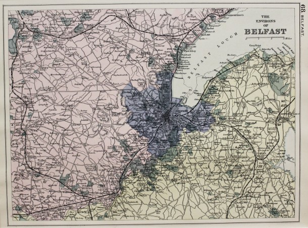
“Environs of Belfast” … 1895 … from Bacon’s “Library Atlas of the British Isles” … 1895 … 9” x 12” (22.8 cms x 30.5 cms) … original printed colour. George Washington Bacon (1830 – 1922) was a London based book and map publisher. His firm G. W. Bacon and Co. purchased the plates created by […]

Read more Like this post0
Close
Go top