Exit

Telephone : +44 (0) 28 7083 4600

Email: info@irishartgroup.com

“Hibernia Regnvm Vulgo Ireland ” c. 1633

“Hibernia Regnvm Vulgo Ireland ” c. 1633… . by Johannes Jansonius Jr. (1588 – 1664). Copperplate engraving… full original hand colour. 15″ x 20″ (38 cm x 50 cm). Published in Amsterdam. Ireland oriented East West. Map Ref 32. Janssonius was born in Arnhem, the son of Jan Janszoon the Elder, a publisher and bookseller. […]

Read more Like this post0

“The Province of Connaught ” 1646

“The Province of Connaught ” 1646 by John Speed (1542 – 1629). Full recent hand colour. 15″ x 20″ (37 cm x 50 cm). Map Ref 25 Speed is recognized as the finest cartographer these islands every produced and his maps are in huge demand. Cambridge University Library describes John Speed’s ” Theatre of the […]

Read more Like this post0

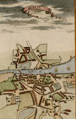
Dvblin … 1686 by Alain Manesson Mallet

Dvblin … 1686 by Alain Manesson Mallet (1630 – 1706)…6.5″ x 4″ (16 cms x 10 cms)… later full colour. from the French edition of his five volume “Description de L’Univers” published in 1683. At the time, this was the largest and most comprehensive work ever undertaken describing the cultures, customs, governments and boundaries of […]

Read more Like this post0

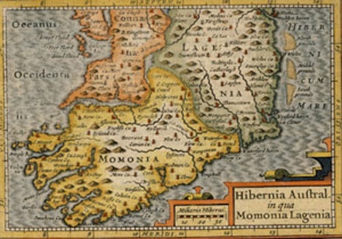
“Descriptio Momoniae in Hiberniae” 1616 by Petrus Bertius

“Descriptio Momoniae in Hiberniae” 1616 . First edition. by Petrus Bertius (1565 – 1629) “4.5” x 6.5″ (11.5 cms x 16 cms) .. full and exquisite early colour…from the Latin edition of the “Tabularum Geographicarum Contractarum”… described by Geoffrey King (Miniature Antique Maps) as “the finest set of miniature maps ever printed”. Bertius was the […]

Read more Like this post0

“Descriptio Lageniae” 1616 by Petrus Bertius

“Descriptio Lageniae” 1616 . First edition. by Petrus Bertius (1565 – 1629) “4.5” x 6.5″ (11.5 cms x 16 cms) .. full and exquisite early colour…from the Latin edition of the “Tabularum Geographicarum Contractarum”… described by Geoffrey King (Miniature Antique Maps) as “the finest set of miniature maps ever printed”. Bertius was the Official Cosmographer […]

Read more Like this post0

“Descriptio Connatiae” 1616 by Petrus Bertius

“Descriptio Connatiae” 1616 . First edition. by Petrus Bertius (1565 – 1629) “4.5” x 6.5″ (11.5 cms x 16 cms) .. full and exquisite early colour…from the Latin edition of the “Tabularum Geographicarum Contractarum”… described by Geoffrey King (Miniature Antique Maps) as “the finest set of miniature maps ever printed”. Bertius was the Official Cosmographer […]

Read more Like this post0
Close
Go top