Exit

Telephone : +44 (0) 28 7083 4600

Email: info@irishartgroup.com

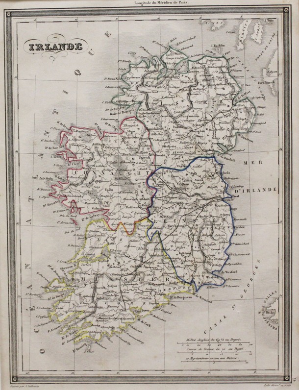
“Irlande” … 1841

“Irlande” … 1841 … Alexandre Vuillemin (1812 – 1886) … 10” x 8” (25.5 cms x 20 cms) … original outline colour. Published in Paris in the 1841 edition of Vuillemin’s “Atlas Universal de Géograph Ancienne et Moderne” which was published initially in 1839. Vuillemin studied cartography under Auguste Henri Dufour (1798 – 1865) and […]

Read more Like this post0

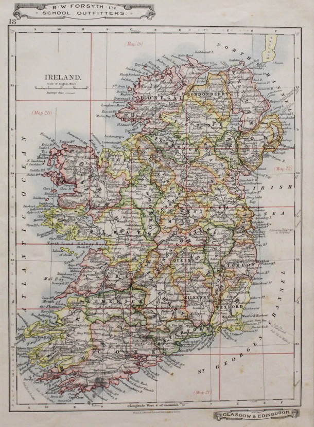
“Ireland” … 1907

“Ireland” … 1907 … from Forsyth … 1907 … a commercial clothing company and manufacturers of tartan 8.5” x 10” (21.5 cms x 25.5 cms) … original printed colour. Printed by Alexander Keith Johnston (1804 – 1871) was a geographer and Fellow of the Royal Geographical Society from 1842. He was the younger brother of […]

Read more Like this post0

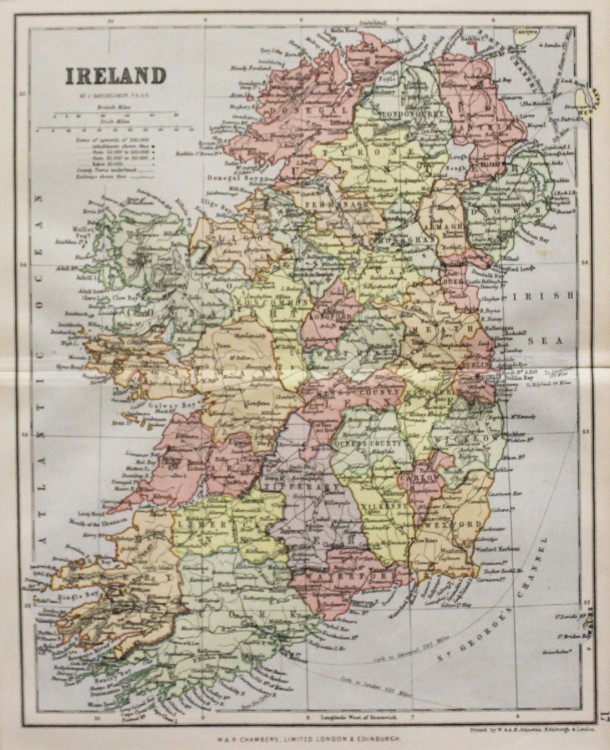
“Ireland” … 1895

“Ireland” … 1895 … from Chambers … 1895 … 8.5” x 6.5” (21.5 cms x 16.5 cms) … original printed colour. Printed by Alexander Keith Johnston (1804 – 1871) was a geographer and Fellow of the Royal Geographical Society from 1842. He was the younger brother of Sir William Johnston, founder of the family firm, […]

Read more Like this post0

“Tyrone and Down” … 1843

“Tyrone and Down” … 1843 … by Alfred Adlard … 1843 … 5” x 8” (13 cms x 20 cms) … later hand colour. Steel engraved map from “Ireland. Its scenery and character” by Samuel Hall published between 1841 and 1843. Samuel Carter Hall (1800 – 1899) and his wife Anna Maria (1800 – 1881) […]

Read more Like this post0

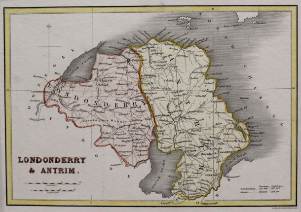
“Londonderry and Antrim” … 1843 SOLD

“Londonderry and Antrim” … 1843 … by Alfred Adlard … 1843 … 5” x 8” (13 cms x 20 cms) … later hand colour. Steel engraved map from “Ireland. Its scenery and character” by Samuel Hall published between 1841 and 1843. Samuel Carter Hall (1800 – 1899) and his wife Anna Maria (1800 – 1881) […]

Read more Like this post0

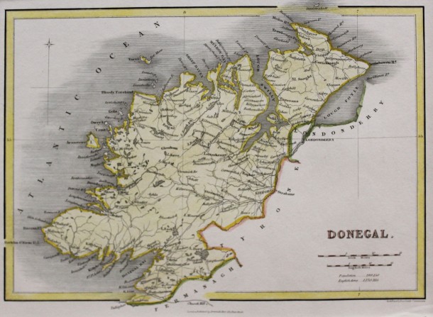
“Donegal” … 1843 SOLD

“Donegal” … 1843 … by Alfred Adlard … 1843 … 5” x 8” (13 cms x 20 cms) … later hand colour. Steel engraved map from “Ireland. Its scenery and character” by Samuel Hall published between 1841 and 1843. Samuel Carter Hall (1800 – 1899) and his wife Anna Maria (1800 – 1881) compiled a […]

Read more Like this post0

Ireland… 1817

Ireland… 1817 .. by Christopher Kelly…10″ x 7.5″ (25 cms x 18 cms) …uncoloured…an attractive map with plain cartouche… from “A New and Complete System of Universal Geography” printed for Thomas Kelly No 53 Paternoster Row by Rider and Weed, Little Britain, London. Map is in excellent condition. Ref. Map 4

Read more Like this post0

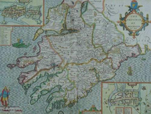
“The Province of Mounster” 1676

“The Province of Mounster” 1676 by John Speed (1542 – 1629). Full recent hand colour. 15″ x 20″ (37 cm x 50 cm). Map Ref 35 Speed is recognized as the finest cartographer these islands every produced and his maps are in huge demand. Cambridge University Library describes John Speed’s ” Theatre of the Empire […]

Read more Like this post0

“The Province of Leinster ” 1676

“The Province of Leinster ” 1676 by John Speed (1542 – 1629). Full recent hand colour. 15″ x 20″ (37 cm x 50 cm). Map Ref 36 Speed is recognized as the finest cartographer these islands every produced and his maps are in huge demand. Cambridge University Library describes John Speed’s ” Theatre of the […]

Read more Like this post0

“The Province of Connaught ” 1676

“The Province of Connaught ” 1676 by John Speed (1542 – 1629). Full recent hand colour. 15″ x 20″ (37 cm x 50 cm). Map Ref 37 Speed is recognized as the finest cartographer these islands every produced and his maps are in huge demand. C ambridge University Library describes John Speed’s ” Theatre of […]

Read more Like this post0
Close
Go top